Making inclusive spaces of trade in Durban

Brittany Morris explores how citizen participation helped transform Durban’s Warwick Junction into a thriving, inclusive market hub which supports traders’ needs and re-establishes public space

Brook Street Market
Brook Street Market

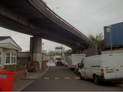
Walking through Durban’s Warwick Junction is a kaleidoscope of colours and a symphony for the senses. The myriad of kiosks and markets, and once-derelict-now-vibrant bridges and overpasses offer a glimpse into the experience of street traders in city life here. The creative use of public space accommodating the traders’ needs is apparent all around you as your feet hit the pavement, traversing wide walkways, a pedestrian bridge, enclosed vendor stalls, and roofed market areas. With 460,000 people and 38,000 vehicles passing through daily, Warwick is Durban’s primary public transportation and trading hub.

Nonhlanhla Zuma is a traditional medicine trader in Warwick Junction. Her trading days began in 1982; at this time, a culture of harassment meant she often had to run from the police and watch her goods being removed. Amenities were not provided to traders and she worked on an exposed street pavement where her goods faced the constant threat of being damaged or stolen. Now, she has moved her business to a kiosk that is complete with water, lighting and security facilities to lock up at night. Nonhlanhla is one of approximately 8,000 traders who come to Warwick every day to trade informally.

Warwick’s past is steeped in racial discrimination, exclusive policies, and neglect. The area’s reputation was one of dilapidation and crime, and due to years of apartheid planning Warwick was segregated racially and divided politically and economically until the early 1990s. During this time the area faced such neglect it became extremely rundown and congested – however as Durban’s market and transport networks expanded, the locational advantages offered a form of employment, and many traders lived on the sidewalks in Warwick to secure their goods. Discriminatory legislation and policies, and violent mass evictions, made life very difficult for informal street traders.

Following the first democratic election in South Africa in 1994, in an effort to transform a poorly designed Warwick into a safer and more inclusive space for street traders’, the Warwick Junction Urban Renewal Project was initiated by the City. For over a decade local officials, street traders and membership-based trader organisations collaborated and negotiated on the project’s redesign of the area. The project’s inclusive approach adopted an area-based management and local inter-departmental operating structure, where participation of all stakeholders occurred on a number of levels.

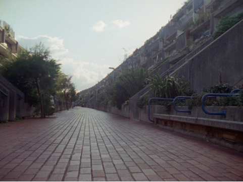
Redesigning infrastructural components of the market area following consultations dramatically improved the trading conditions: priority was placed on increasing pedestrian routes, widening walkways, and easing congestion of primary trading hubs. The trading area was paved, shelter and locked storage facilities increased, trader kiosks with water and electricity were constructed, and new spaces were developed for traders.

Muthi market
Muthi market

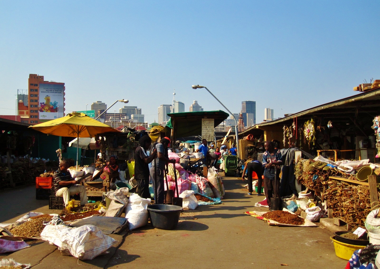
With approximately 700 traders, Warwick’s muthi (herb and traditional medicine) market is one of the largest in South Africa. Customers approach the herb traders and traditional healers with their illness or ailment (anything from a stomach-ache to a broken heart) who then diagnose and prescribe their medicine. Once an abandoned overpass, facilities were built for the healers and traders and now the muthi market thrives and is connected by a pedestrian pass to other markets in Warwick.

The infrastructural changes and repurposing of empty space supported the traders’ needs, and created healthier, less congested, and safer public spaces. The participatory processes and innovative operating structure included in the urban renewal of Warwick were central to the project’s success of revitalising the area as an inclusive space for street traders and the informal sector on the hinge of Durban’s inner-city.

Warwick’s revitalisation has led to economic development including community-based tourism opportunities, and continues to contribute to the local economy and provide employment. Informal trade turnover in Warwick Junction is estimated to be R1 billion annually. There are very few examples in South Africa and internationally where street traders have been acknowledged for their contributions to cities or included in urban plans and development projects.

The early morning 'Mother Market'
The early morning ‘Mother Market’

Traders, their organisations and allies continue to collaborate and advocate for inclusive public spaces and street traders’ right to the city. Asiye eTafuleni is a non-profit organisation who works with Durban’s informal workers operating from the city’s public spaces. AeT advocates inclusive urban planning and design, and serves as a learning hub for those interested in integrating the informal economy into urban design. Through consultative and participative processes AeT has led various projects and campaigns within Durban to develop informal workers’ working environments and opportunities, such as the Inner-city Cardboard Recycling Project and Markets of Warwick Tour Project. Asiye eTafuleni means ‘bring it to the table’ in isiZulu, and they are living up to their name – engaging with the public and stakeholders to make inclusive space for Durban’s informal traders in an urban environment that recognises the informal economy’s contribution to city life and public space, as well as the rights of informal workers.

Warwick’s street traders still face challenges, such as under representation in urban-decision making processes and policies, and proposed development projects. Although the benefits of the informal trading sector’s contributions to creating inclusive, sustainable and vibrant cities are often ignored and undervalued, traders, their organisations and allies continue to collaborate and advocate for inclusive public spaces and street traders’ rights to the city. The success of the Warwick Junction project is a testament to how including street traders in urban plans supports sustainable livelihoods, addresses poverty and unemployment challenges, and creates democratic public spaces that are safer, more inclusive and contribute to city vitality and overall urban connectivity.

This is an edited version of a post which originally appeared on Vancouver Public Space Network. All photographs author’s own. Brittany Morris is a researcher and writes about inclusive urban environments, public space and creative community engagement. 

There They Carved A Space

This is an adapted extract from Emilia Weber and Claire Healy‘s There They Carved A Space – a performance essay investigating the history of space, land ownership and housing. The full piece was performed at The Yard Theatre in May 2015

Take C to Kenwood Ladies’ Pond. Past the sign on the gate that reads: ‘men not allowed beyond this point’, under an arch of green and into the dark silky pool with its familiar taste of mud. We share gliding smiles with other swimmers, the warm community of women.

In the meadow surrounded by the hum of other bathers C talks about swimming in Cork, upstream by the Lee fields. I tell her how my dad hates cities with no outdoor swimming amenities, how the lack of such places makes him want to smoke cigarettes, drink whiskey and maybe have a cake with artificial cream in it.

Fleet Road, down to Swiss Cottage, past Basil Spence’s library. C and I pass the Hilgrove flats with their beautiful chunky framed balconies and bend onto Alexandra Road and into the estate – the stadium-like curve you pass on the Virgin Pendolino Glasgow to Euston – the last large social housing complex to be built in London. Designed by Neave Brown and completed in 1978 these are ambitious and expensive flats that were funded by raising taxes from the surrounding, rich neighbourhood. We stop to film – the swim has thrown us off track and we’re tired. But the architecture lifts us, the concrete, the plants hazy and European.

Further into the margins we hit Ballard’s Westway, his ‘stone dream that will never awake’, the two and half mile elevated section of the A40 running from White City to Paddington where it travels into the Marylebone Road.

A group of Irish travellers live encircled by three A-roads and a train track among the concrete pillars that shoulder the hulk of the Westway. Neat rows of caravans, kids heading off to school.

The residents have long argued that the location of this site is not an appropriate one, under the drumming motorway they are exposed to lead poisoning – but the council claim that there is no alternative space.

We’re told about a regeneration scheme on derelict land right next to the Westway site. The plan for this includes 11 buildings of up to 32 storeys, shops, restaurants and bars and 1000 homes, going ahead while the travellers’ repeated pleas for better accommodation are ignored.

Stables Yard – the surreal sight of ponies trotting beneath the traffic. North Pole Road, Mitre Way. C talks about coming over from Ireland to visit her aunts, the hottest summer on record. Behind us the sweep of the motorways converging, Trellick Tower framed in the distance and past the BBC to White City the site of the 1908 Olympics – an emergency measure after the eruption of Mount Vesuvius.

London to Glasgow – it takes a long time to return. We start to film Glasgow’s truncated walkways, the city’s concrete centre haunted by the ghosts of the Bruce Plan. We stop at the Kingston Bridge arching magnificently as it carries the M8 traffic north and south. Named after Glasgow’s first enclosed dock – 823 yards of quayside between Anderston and Tradeston – and a reminder of the city’s unacknowledged part in the transatlantic slave trade. The dock finally closed in 1966 when work on the bridge began. I tell E how an optimistic Clyde Port Authority had insisted that it had a clearance height to allow dredgers upstream.

We set off on our bikes, cameras round necks. Saltmarket heading east through Glasgow Green. We approach the Clyde Gateway Area, with its tracts of derelict land. The £5.6 billion Clyde waterfront project plans to transform 13 miles of the Clyde river corridor. The roads are empty – regeneration appears natural, irresistible. We speak to two no-voters who are curious at our filming. They begin to name the wild flowers: poppy, corn flower, campion.

Past the site where the Accord Centre once stood – the day care centre knocked down to provide parking space for the recent Commonwealth Games. Still to be replaced, the protests about the centre continue – the new Emirates Arena watches, prominent on the skyline. We arrive at the Athletes’ Village site, all fresh tarmac, and dusty saplings. Here 3,000 people have been displaced through phased demolition of existing social housing. The ‘new community’ on the Clyde will displace the old one.

We see the huge new police headquarters being built – spaces for wandering now enclosed. The big banners across the fences read ‘Clyde Gateway Legacy – an international competitive belt for business, employment, living and tourism.’ Bridgeton, Dalmarnock, Rutherglen, Calton, and Parkhead.

We stop to film Gallowgate Towers. Due to be demolished in 2017 as part of a ‘transformational regeneration area’ that brings with it the reduction of 10,000 social rented homes. As we circle home along London Road we talk about how the entire public housing stock of Glasgow was transferred to a private organisation in 2003, about the influx of glistening new developments, how housing is now an asset rather than a place to live.

All images courtesy of the authors and all rights reserved


Infra-structured landscapes

Adriaan Geuze and Matthew Skjonsberg explore the social impact and negotiation of urban infrastructure – and the the advocatory role landscape architects can play in designing public spaces

The High Line park in New York. Source: boomsbeat.com

Infrastructure can be wielded as a means of promoting the common good or as an institutional weapon of exploitation. While the highways, bridges and dams funded by international economic interests and built in outlying regions like the Amazon play a role that is difficult to conceive of as being anything other than devastatingly exploitative, the public parks and greenways of the world’s major cities also clearly serve economic functions while delivering a variety of benefits to the common good.

Infrastructure can be conceived of as opportunistic and multilayered, serving explicit functions of enabling mobility, energy, and communications – but also potentially prioritising access to light, air, and water: creating open space for social gathering and spatial continuity for ecological habitats. This is true whether infrastructure is regarded as a public space or as private commodity. Semi-public spaces now proliferate in major cities. Of course, the term ‘semi-public space’ is effectively a euphemism for ‘private property’, and while this trend might be criticised, there are also examples of these spaces being used in such a way as to provide alternative commons when the public are denied their right of free access to public space.

For instance, when in New York City the Occupy Wall Street movement was prohibited from gathering in public space on Wall Street itself, the protesters instead inhabited nearby Zuccotti Park. A small granite plaza in close proximity to the New York Stock Exchange, Zuccotti Park is one of over 500 ‘bonus plazas’ built in the city – privately-owned public parks created according to a little-known law established in 1961, the result of a compromise struck between the city and property developers.

The law states that should developers desire to build a taller skyscraper than zoning would otherwise allow, they can construct a compensatory plaza that provides ‘light and air’ for passers-by: the taller the building they desire, the bigger the plaza they must build. These bonus plazas are generally required to be open 24 hours a day, barring a safety issue, and they are governed by specific regulations in the zoning law. The law states that the layout of such plazas must provide easy pedestrian circulation throughout the space, and, thereby, promote public use.

Police presence at the Occupy Wall Street protest camp in Zucotti Park, October 2011.

Indeed, this was effectively the case at Zuccotti Park from the arrival of protesters there in September 2011 until police forcefully evicted them in a raid two months later. When protesters initially occupied the park the only rules visibly posted there were: ‘No Skateboarding, No Rollerblading, No Bicycling’. Subsequent to their arrival, the owners of the site made public an additional set of rules banning everything from erecting tents and tarps to lying on the benches, although these rules were not enforced until the November police raid.

At that time barricades and police presence were established so as to discourage protesters from returning, and those who chose to enter the park were subjected to search and checkpoints monitored by police. This situation persisted until, in January 2012, civil rights groups filed a complaint with the city’s building department, asserting that the barricades were in violation of the city’s zoning law as they restricted public access to the park – stating that by allowing the barricades to exist the city was failing to enforce the law. The barricades were swiftly removed, and open access to the park was once again provided.

The High Line Park in New York, also a ‘semi-public space’, generated controversy when park officials brought in police to arrest an artist – Robert A. Lederman – selling his work there. After his release, Lederman vowed to return to vend his art on the High Line, and he did so – only to be arrested once again by Park Enforcement Patrol officers. The current city administration then stepped in; Lederman was personally contacted by the Parks Commissioner, who informed him that he would not be arrested again, that the charges against him were dropped, and that the Parks Commission had begun developing terms by which to accommodate artists and other vendors on the High Line.

The High Line
The High Line

Clearly, the struggle over infrastructure and public space is an ongoing negotiation – in contrast to the relatively amicable outcome in the case of the High Line, following the 6-month anniversary of the Occupy Wall Street Protests hundreds of protesters were again evicted from Zuccotti Park, and 73 arrests were made by police who used batons and tear gas in dealing with the crowd, dramatically illustrating the sometimes emphatic nature of this struggle. Among the perennial questions that persist is under what circumstances the rights of one group or interest are to be diminished by those of another, and whether infrastructure, by virtue of its interoperability, can be an effective means by which to reconcile disparate interests.

As designers, we talk about space, not politics – but we are aware that the two are interrelated. As distinct from visionary cities of the future, we are particularly interested in learning from the urbanising processes at work in the day-to-day creation of real cities and the role of infrastructure in these processes.

There is always the risk that the designers of infrastructure – whether architect, landscape architect or engineer – become merely technical enablers of narrowly focused interests all too often purely intent on short-term economic gains. We might imagine that megaprojects like the Three Gorges Dam in China – which along with the ‘green energy’ it provides has had negative social and environmental impacts that are widely acknowledged – are inherently more harmful than, for instance, the infrastructure needed for internet service.

Three Gorges Dam, China. Source: Reuters

We believe in the proactive assertion of designers to champion the reality of interests beyond those financially vested in the work. In this regard, it is necessary to acknowledge that the disciplines of architecture, landscape architecture, engineering and construction all operate extensively within the public realm: to reach decisions and to establish finances we have to work with politicians, local citizens, and bureaucracies with quite diverse systems.

We must deal with outreach, public opinion, interaction, legal systems, implementation, and compromise. Our disciplines cannot avoid responding to socio-political contexts. While this situation might be regarded as a liability if design intent is fixed on a single predetermined outcome, it can also be seen as a real opportunity to engage the fluid condition of the city’s evolution – and to develop a mindset that can be characterised as ‘radical contextualism’.

Considering both the historic and contemporary phenomenon of the privatisation of common resources – whether water, air, and light or mobility, energy and communications – infrastructure is fundamental to civilization’s second nature, that body and activity of civilization that provides both connection and buffer between ‘nature’ and ‘city’, and between community interests and individual interests. Do we, as designers, effectively embrace our conciliatory role in making these resources available to the public? Are we willing to accept our responsibility if we fail to proactively advocate the public good, and design infrastructure that fails – in one way or another – to acknowledge context?

Now is the time to get a handle on our intentions, compare them with the outcomes of our efforts – and if the two are not convincingly aligned, make a change. Best, a radical one.

This piece is an edited version of an article titled ‘The Interoperative’ first published in Oz Journal, Volume 34. Adriaan Geuze is the founder of West 8 urban design and landscape architecture. Matthew Skjonsberg, architect and urban designer, is a Ph.D. researcher at the École Polytechnique Fédérale de Lausanne (EPFL)


Dreams of home

From Metro-land to Battersea Power Station, Kenn Taylor confronts the problems of selling a housing fantasy

Battersea Power Station. Photograph: Kenn Taylor

London’s suburban ‘Metro-land’, celebrated in the writings of John Betjeman, was created and branded as such by the Metropolitan Railway as it built its route out of London in the first half of the 20th century. The company famously promoted Metro-land aggressively and creatively, even having songs written that extolled the virtue of the new housing estates it built along the route of the line. A private precursor to today’s Stagecoach or FirstGroup, the Metropolitan Railway didn’t build Metro-land to inspire poets though, but to make money by selling the dream of country living to those who could afford it.

It was Metro-land I thought of as I explored the very different environment of Battersea Power Station. This monolithic exercise in brick by Giles Gilbert Scott is, after years of decay and dereliction, being turned into a new residential development with both Norman Foster and Richard Rogers working on elements of it. I was privileged to see it close up before its transformation and pleased that it would find a new use other than to decay into dust. Yet what struck me most as I wandered through, were the slogans on the brightly-coloured construction hoardings around it, like those that accompany almost every major, high-density urban development these days:

A PLACE OF VISION AND MAJESTY; A THRIVING. DIVERSE AND SUSTAINABLE COMMUNITY; AN ICONIC RIVERFRONT ADDRESS; A CULTURAL POWERHOUSE

Just as the songs and pamphlets advertising Metro-land once promised, the hoardings around the Battersea Power Station development promote a lifestyle keenly desired by much of the aspirational middle class. It’s marketing, of course – and whether it’s a fridge, a car or a home, they long ago realised that if they sell you an idea, a dream and a lifestyle rather than just a product, you’re more likely to spend.

In reality though, the creation of Metro-land saw fields torn up and replaced with row upon row of near identical housing. Rural ways of life were replaced by the thousands of commuters leaving every morning to their work in the city via a concrete tube station and returning later to live out an image of the country idyll. For many, this is still the dream, a dream which year on year sees ever more green space turned into housing, driven by the desire of so many of us to have our own personal version of the ‘lost Elysium’ Betjeman wrote of.

Metro-Land_(1921)

More recently though, we have seen the development of a new idea of Elysium that, just as 100 years ago, property developers are only too keen to sell to those with the means. That is the lifestyle of living in a THRIVING, DIVERSE AND SUSTAINABLE COMMUNITY and a CULTURAL POWERHOUSE such as is now promised at Battersea.

This desire for a certain kind of urban living that has ‘cultural authenticity’ dates perhaps from the same 1960s when Betjeman was writing of his distaste for the demolition of Victorian and Georgian buildings for new developments influenced by Modernism – most prominently campaigning to save the former Midland Grand Hotel at St Pancras station, which was designed by George Gilbert Scott, father of the Battersea Power Station designer, Giles.

Many of the people who backed Betjeman’s cause were amongst the first ‘gentrifiers’, those part of the phenomenon identified by sociologist Ruth Glass in 1964. The suburban dream of Metro-land began to be less desirable for some by the 1960s, while the inner-city – where, in the earlier 20th century at least, people only generally lived if they could not manage to live elsewhere – began to be seen as more attractive.

As I have discussed previously, ‘creatives’ play a key role in this process: for years artists, critics and the like left the ‘comfortable’ suburbs in search of the ‘truth’ and the ‘real’ in the inner city, most of all what they perceived as ’culture’. Or rather, they headed for the ‘outer’ inner city, away from actual centres of business, tourism and authority, but not so far out as to live in the middle-class suburbs. They moved to areas by and large populated by people who could not afford to live either in the centre or the suburbs.

It was these fringe places that were seen as the edge of capitalism, set apart from the bourgeois self-satisfaction and complacency of the suburbs as well as the glitzy centre. In these locations, artists could live cheaply, with plenty of space for their activities. Such locations became the home of a class of people who came from all over to take up what they saw as ‘authentic’ urban lifestyles.

Gentrifiers made such areas more desirable and thus eventually more expensive, leading to the displacement of poorer residents. This prevented new ‘creative pioneers’ from settling and so forced them to seek new places to occupy. Where the artists lead, the capitalists capitalise, selling the opportunity to live in A CULTURAL POWERHOUSE to those who can afford it, albeit perhaps one with security gates between the property and the DIVERSE COMMUNITY. The term ‘village’ is often bandied about in such developments, for those who wish to combine the security and order of a ‘village’ with just enough of an ‘urban cultural’ feel.

Battersea Power Station hoardings. Photograph: Kenn Taylor

Yet such areas are neither villages nor urban cultural powerhouses. These new ‘suburbs’ are literally Metroland, the city as fantasy consumer product. Gradually, the ‘authenticity’ and ‘edginess’ that generated the desire for many to live in such locations declines and, more often than not, they become home to a wealthy monoculture, living in generic apartment blocks with, if you have the means to afford it, ‘heritage features’. A carefully managed version of the city, created for those who wish to embody a particular lifestyle by those with an interest in profiting from land. Much as a carefully managed and accessible version of the countryside was created for the dwellers of the Metropolitan Railway’s new housing estates.

“If the older generation looked to the suburbs for romantic middle-class communities that represented a new way of life,” Irving Allen wrote in the 1980s, “some members of the young generation may well be looking to cities for romantic middle-class communities that represent an alternative to the suburbs…it is safe to assume that many of the new settlers are seeking a selective, buffered, and entertaining encounter with the social diversity of city life. Their parents sought a selective, buffered, and entertaining encounter with small-town and ‘rural’ life.”

Metro-land cut Mock Tudor furrows through rural Middlesex and sold former city dwellers the country dream to the point that what they liked about that countryside largely disappeared. So too the developers of the late 20th century sold the urban dream to those who fled the Metro-land suburbs, to the point where these new residents ended up helping to drive away what it was they perceived to be authentic about the city. Replacing it with non other than a more high-density version of suburbia, packaged, just as Metro-land was, with slogans promising a life that has already disappeared, if it ever even existed.

Such processes have been happening since at least the 1960s. However, recently, a new gentrifier generation has emerged that embraces rather than resents Modernism. To these rebellious aesthetes, the Brutalist architectural works by the likes of Erno Goldfinger and Alison and Peter Smithson – once reviled by gentrifiers for their role in the destruction of old Georgian and Victorian neighbourhoods – are the new objects of residential desire.

As 18th and 19th century housing once occupied by working class people became home to wealthy residents, so today former concrete social housing like the Trellick Tower in west London and Sheffield’s Park Hill, the latter renovated by trendy property firm Urban Splash, become home to new ‘pioneers’ keen on a new type of ‘character’ property.

As a previous generation saw new possibilities and a sense of nostalgia for the 19th century city as a reaction against collapsing Modernist ideology, so this generation is filled with nostalgia for the Modernist vision of utopia as Neo-Liberalism crumbles.

Scott Greer considered the ideology which rejects the contemporary for an imagined better past, whether urban or rural, labelling it as ‘conservative utopian’: “At one time they believed the rural life to be the only one fit for man, the city evil. Today they remain fixated on the past, but it is now the dense, polyethnic, centralized city of the railroad age.” As the Romantics inadvertently brought urbanism to the country by helping to spark the desire for ‘Metro-land’ and the first gentrifiers brought the suburbs to the city, so now the Modernist urban fringe is the new frontier. Yet this generation’s dreams will likely have as similar unintended consequences as previous ones as they look back to a supposed better past without the knowledge of what was wrong with it. 

The more people try to embody a particular lifestyle through property and location and escape what they perceive as contemporary corruption, the more they corrupt what it is they try and inhabit. As John Betjeman once wrote of the loss of rural idyll and Victorian wonders so today the press is littered with tomes on the loss of inner city culture and authenticity, almost inevitably penned by the same people who began such changes.

Of course, many do protest at all of this. Yet since Ruth Glass first noted gentrification, save for some successful islands of resistance and peaks and troughs caused by recession, the market forces of Britain continue to drag development in both directions to sell everyone who can afford it the country dream or the city dream, or, if you have enough capital, both, however diluted dreams both have become.

The urban life those billboards in Battersea promise is just a much a fantasy as that sold in the songs of Metro-land nearly 100 years ago and just as alluring. Meanwhile, Battersea’s new residential community is to be opened up, just as Metro-land was, by a new Tube line connecting it to The City.

The more this all turns, the more London in particular is transformed into a total fantasy, Metroland, an urban playground for those with the means. Everyone keeps on chasing, hoping that, if they try hard enough, they will get their own little residential dream, whatever happens to anyone else. And those who paint pictures of our perfect lifestyle remain only too keen to sell us the ticket to it and tell us: Elysium is still waiting.

This is an edited version of an essay which can be found on Kenn Taylor’s blog

London: traversing the city’s stories, line by line

by Charles Critchell

Central London tube map, 1937. Source: The London Tube Map Archive

Lines, points, and colours: the Tube map has become ingrained in my consciousness. Having moved to London and set up shop in a hostel off Gloucester Road, curiosity naturally got the better of me. It just so happened that my move coincided with the 150th anniversary of the Tube, and, to celebrate, Penguin published twelve books – a different story for each line. I quickly set about hatching a plan. The rules were simple: each book could only be read on, or at, a destination on its corresponding line, and this arguably excursive adventure would almost exclusively occur on a Sunday.

To think that such a great city as London can be reduced to lines, points and colours is disconcerting, though look a little harder and you soon realise that for many Londoners this is London. Harry Beck, the Tube map’s architect, immortalised an icon below ground to rival those above, whilst the tube would go on to shape the suburbs that define the city as the vast, sprawling entity standing today.

I soon realised that Beck’s map was not only a tool which would enable me to navigate my way around the city, but a gateway to what could turn out to be some interesting experiences, a bit of fun, and who knew what else? Here are a few of those journeys.

Beck’s London Underground map from 1933

 Nostalgia and memory

Living and working on the Piccadilly Line made Peter York’s book the natural place to start. In The Blue Riband, York talks of ‘Big London’ destinations, and refers to place names so romantic and nostalgic that you feel you always knew them: Hyde Park Corner, Piccadilly Circus, Covent Garden… This assemblage of well-heeled addresses oozes empire and old world money. It is the line most frequented by tourists, which was exactly how I felt when I first arrived – impressed, indulgent, and yet mildly embarrassed for being so. In time, my sense of passing through was replaced with that of a weary worker, as my job as a construction site manager soon bred a familiarity with the places I was based.

Events and belonging

The Central Line found me tracing the route of the London Marathon from St Paul’s down towards Monument. In his book, The 32 Stops, Danny Dorling likens the Central to the trace of a heartbeat on a cardiac monitor. Walking against the sea of runners as they neared the 24-mile point got me thinking about this analogy.

Although my involvement was limited to watching – and occasionally shouting words of encouragement – it gave me a sense of camaraderie – a sense of belonging.

I had the same feeling when I had waited at St Paul’s only a few days before at the funeral of Margaret Thatcher – the carnival atmosphere replaced by a more sombre one, though still expectant, still excited nonetheless. It is the city’s ability to host these spectacles, ones both long in the making and others more impromptu that gives it the capacity to either to delight or disgust. Rarely is there indifference.

Detachment and displacement

Indeed the sensation of belonging is more commonly offset by that of detachment. Whilst you can seldom escape people in the city, you can certainly feel alone; caught up in your own grinding routine, being propelled forwards by unseen forces indifferent to your feeble remonstrations.

This is something the Tube re-enforces, particularly the Bakerloo Line, with its beaten-up stock, springy seats, and that overpowering musk. It is this familiarity which sets you at ease, giving way to vacant stares, and numbness to those around you. Perhaps it is the Tube’s willingness to become that ‘third space’ which allows Londoners to cope with the pace of everyday life, detachment as a break from the world above.

Escapism

Detachment, displacement, escapism; call it what you like, the luxury of feeling as if you’ve physically left the city when in fact you have not, was where the Northern Line, unexpectedly, fitted in. The bloated black line, which seemingly envelops London, is a source of constant mistrust and anxiety in William Leith’s book, A Northern Line Minute.

For me though, at the height of a long hot summer, it spelled escape; the villages of Highgate and Hampstead to the north and the sprawling fields of Clapham Common to the south, bookending the dense mass in between.

Illustration by Charles Critchell

Chance encounters

The luxury of being able to meander around unhurried can lead to a certain type of chance encounter, the sort which punctuated my Tube-based wanderings. From stumbling upon tucked away community gardens such as those in Vauxhall or Angel, oases successfully resisting the urban furore around them, to clambering up the Monument for a panoramic view of the London Marathon. It’s the small breaks the city throws up which leaves you optimistic of more.

Then there are other encounters, a product of the frantic pace of city life, which confront you head-on and can lead to people and places both irresistible and inescapable – potentially life-changing discoveries, as opposed to merely welcome distractions. Alighting at Bethnal Green on the Central Line led me into a family-run boxing gym, where I was taught by a former Olympian.

An exchange of uncertain smiles with a girl sitting opposite me one day led to a six-month relationship. It was only after she had kissed me on the cheek, on a Tube at Piccadilly Circus, the place we had first met, that I realised it was to be the last time we’d see each other.

Completing all twelve books had taken me a little over nine months. In that time I had experienced many things: some I was searching for, whilst others had simply washed over me. While these stories provided the framework for my city-wide excursions, it is the Tube itself that remains the catalyst; part of the machinery which ensures the irrepressible wheel of the city continues to turn, and that life goes on.

Istanbul: They Call it Chaos, We Call it Home

by Naela Rose

Photograph: Oliver Zimmermann
All photographs: Oliver Zimmermann

The cobbled pavements teem with a buzzing frenzy of people. Tourists, locals, street-sellers and punters alike create a steady stream of bodies, flowing consistently through the narrow streets of this heaving city.

Whether you love or hate it, Istanbul is without doubt a city that splits opinion. For some, it is an exotic metropolis – steeped in rich history and culture – pulsating with modern life. For others, the city environment is pure chaos. Many local people feel that Istanbul is over-crowded and over-developed; a suffocating and homogenised urban landscape, representative of the negative consequences of capitalist culture.

The fact is, both the physical place and conceptual space of Istanbul remains at odds with the sheer quantities of people that inhabit the city; Istanbul is one of the most over-crowded cities in the world, with a population of approximately 15 million and rising. The city sprawls over 2,063 square miles, spanning the Bosphorus Strait that separates East and West, forming the largest urban agglomeration in Europe and the Middle East.

For me, this colossal city is the very definition of contradiction. Everything here happens in extremes and changes rapidly. Around the corner from my flat in Galata, a small independent pop-up shop sells foreign coffee, fair-trade T-Shirts and illustrated posters that read: Istanbul. They call it chaos, we call it home. I bought one to remind myself why I like living amid the pandemonium of this urban jungle, in all its gloriously paradoxical charm.

Istanbul is a patchwork of dazzlingly busy spaces that never seem to sleep – and for this reason it can at times be an exhausting, even claustrophobic, city to inhabit. However, historically Istanbulians have always conducted their business in the open, always out on the street. There is an inherent sense here that outdoor space belongs to the public. The streets are occupied daily with tradesmen selling their wares, exchanging produce and sharing stories. Unlike the common conception of public space in large cities in the Western world, the streets of Istanbul have traditionally been considered as an open playground, within which trade, performance art, and food culture thrive.

Turks are not afraid of public displays of emotion, nor are they shy about public appearances. Couples argue passionately in the street, crying and yelling at each other; old men laugh and goad each other while playing backgammon and drinking çay together on the roadside; street children sell tissues, phone batteries and chewing gum; food merchants sound their street calls, advertising their wares on every corner. However, despite the vibrancy of Istanbul’s street culture, the outdoor areas of the city remain intimidatingly hectic and over-crowded. The city consistently overflows with people, relentlessly vibrating with noise and energy, car horns screeching day and night. As a result it possesses a tumultuous, even oppressive, atmosphere.

These days, there is also a menacing police presence in central areas of Istanbul. Since the 2013 Gezi Parki protests in Taksim Square it has become clear that public spaces are controlled and shaped by anyone but the public. What had initially begun as a wave of peaceful demonstrations in the city’s central park soon developed into massive civil unrest, resulting in violent and prolonged riots between protestors and Turkish police. Since Gezi, street culture in Istanbul has been gradually eroded by the ongoing threat of police violence. The controversial issue of public space is made more complex by the current government’s totalitarian approach to crowd control within Turkish cities. As a result, citizens’ civil rights – such as the right to public assembly, peaceful protest and freedom of speech in the streets – are being systematically eradicated.

Today most Turks rightly feel a sense of fear and paranoia about the way in which the government controls public spaces. I still cannot get used to walking amid the multitude of stern-faced, uniformed officers, each of them armed with loaded machine-guns, batons and tear gas pistols. Furthermore, the de-humanising effect of Istanbul’s over-developed, heavily moderated public spaces – particularly green spaces – under the AKP government has diminished its citizens’ ability to have their say about how public spaces are used. There are currently growing rumours that President Recep Tayyip Erdoğan will in fact go ahead with construction in Gezi Parki this year; many Turkish websites state that the government is preparing to push forward with building plans for the original shopping mall, which was the catalyst for the 2013 riots.

Among most Istanbul citizens there is a growing sense of disempowerment within their frenetic urban environment and oppressive political system. They have not forgotten the brutality of the Gezi movement – which shook their city, killing 11 citizens and wounding 8,163 more – nor have they forgiven their government’s heavy-handed occupation of the streets that previously seemed to belong to the people. Many locals feel constricted by the sheer lack of free space in Istanbul: they find the oppressive urban landscape increasingly depressing. My Turkish friends complain that there are not enough accessible green spaces within the inner-city districts in which they might claim respite from the stresses of everyday modern life. They feel there is too much traffic and too many people, too much noise and seemingly endless construction work; they say the city is utter chaos.

Some pro-government supporters argue that the economic boom, made possible by the success of the construction industry in Turkey, has enabled Istanbul to become a thriving, cosmopolitan player on the world stage. But at what price? According to the Istanbul Metropolitan Municipality, the green area ratio per person here is on average only 6.4 square meters. The standard living space here is made up of chock-a-block apartments without access to any gardens, or courtyards at all. In some districts it is hard to spot a single tree, let alone a park. Indeed, capitalist industry has meant that Istanbul has fallen victim to relentless, out-of-control development. Today, this internationally revered metropolis is becoming one of concrete, conflict and over-crowding, with an ever-rising population.

Yet, perhaps it is not too late for the authorities to reconsider how Istanbul’s public spaces function. Many Istanbulians believe that the government needs to start making ‘green’ choices. A possible solution could be to pedestrianise specific areas of the city and to limit government funding for the unnecessary construction of yet another shopping mall. I personally believe that in order to retain a democratic approach to public space, it must be the job of the government to moderate industry, to control construction and pollution, and to listen to the voices of its citizens.

Although the world may regard Istanbul as a great cultural destination, the Turkish people who live here feel that their voices are being silenced. They remain deeply concerned about the issue of public space in their rapidly growing city. While there are no simple solutions for the dilemmas posed by living in such a large metropolis, there are also many positives. Istanbul is a multifaceted place that still has so much to offer – not to mention the beauty and magnitude of its geographical formation.

If you walk down the hill from Galata, through Karaköy, away from the inner-city chaos and towards the coastline, you can watch sunlight dancing on the Bosphorus and glistening along the silhouettes of mosques scattered across the horizon. You can sit and drink çay by the waterside. Here you can look out over the only truly open space left in Istanbul. By the water’s edge, with the commotion of the cityscape at your back, you can feel the sea breeze on your skin. Here you are able to get perspective and take a much needed breath of fresh air.

 All photographs by Oliver Zimmermann and all rights reserved 

LA’s public works: Rethinking the city’s transport infrastructure

by Charles Critchell

Illustration by Nate Kitch

Los Angeles divides opinion. For some it is a land of sun-drenched beaches and palm-lined boulevards. For others, car-choked freeways and a monotonous urban fabric – dominated by its sprawling grid – are the images which live longest in the memory. The fact that it is all these things, and more, is no doubt why it can be considered so divisive; the perception of Los Angeles the place versus the lived reality of Los Angeles, as a place. Friends had been quick to caution me before I had left to visit. Their warnings – from the impossibility of walking anywhere and the problematic public transport, to how I would simply dislike the place – fell largely on deaf ears.

So, when a couple of weeks later I had alighted from the serenity of an air conditioned bus having carelessly missed my stop, I enthusiastically took to the sidewalk to prove them wrong. As I slogged my way back along La Brea Boulevard however, it soon became increasingly difficult to ignore both the searing heat and those voices that had told me it would be like this. The sheer distance between intersections and the comparative monotony of the cityscape, with its low-rise urban fabric and broad swathes of concrete began to feel consuming. Likewise the constant negotiation of the sidewalk for any shade from an unrelenting sun quickly became exhausting.

Los Angeles: the dominance of the car

The frustration of feeling as if you’re going nowhere fast is, of course, exacerbated by the traffic. Waiting for it to subside before a series of illuminated white figures beckons you forward can often feel like an eternity, whilst waiting for the next bus can feel even longer. Whilst Los Angeles’ well-known dependency on the car renders its sidewalks and public transport networks free of overcrowding, it can, however, rarely be considered high quality public space. This realisation soon took hold as I recounted my effortless traverse of San Diego’s Gas Lamp quarter only a few days before.

The Grid typology, common to many major US cities, was the urban model of choice for quickly and efficiently subdividing land for real estate, still a major consideration in the state of California but more specifically in Los Angeles itself. Though unlike Los Angeles, neighbouring San Diego favoured smaller block sizes as a means of creating a higher number of profitable corner plots, thus capitalising on the commercial value of the land. So why hadn’t Los Angeles followed suit?

San Diego
San Diego

Firstly, Los Angeles is still a comparatively young city, with a grid system designed to embrace the automobile and the promise of the utopian future it was hoped it would deliver. By contrast, San Diego and many of Los Angeles’ East Coast rivals were purposefully laid out to accommodate horse, carriage and pedestrians, resulting in narrower streets and a tighter urban grid. Of perhaps greater significance is the sheer scale of the Los Angeles basin, which constitutes the informal annexation of both beach and foothill cities into the city of Los Angeles itself.

Successfully connecting these geographically disparate communities has demanded some huge infrastructural moves over the years, with the proliferation of sprawling highways and the cities ‘super grid’ very much key facilitators. Whilst these facilitators have long been acknowledged to lend the city the unique character it possesses today, dig a little deeper and you find that this wasn’t always so. Long regarded as ‘The Mobile City’, it was actually a thriving public transport network which delineated Los Angeles urban form. Pacific Electric railway cars ran everywhere, and when the automobile arrived, freeways and Boulevards literally ran along their tracks.

The age of individual travel coincided with the rise of another phenomenon which can be seen to be integral to the psyche of Los Angeles the place: mass consumerism. As impressed as I had been by the towering conglomeration of billboards residing not only on Sunset Strip but other linear neighbourhoods amongst the grid, what was possibly more noticeable was the total absence of any advertisement on public transport. Huge sterile ticket halls, scantily-clad subway platforms and unerringly bare buses, seemed so out of character with the place as to suggest that you weren’t in Los Angeles at all.

Likewise, step a street back from any of the main shopping drags and you are cast into a veritable no man’s land of vacant parking lots, breakers yards and industrial compounds – wide open spaces essentially devoid of people or human interaction. It’s these two sides of Los Angeles that is perhaps the most striking thing about a visit to the city, the conspicuous excess alongside the unnerving emptiness.

Los Angeles
Los Angeles

Whilst this is an inherent and accepted fact of Los Angeles life, could measures not be taken to improve the experience of the pedestrian and public transport user? Could private investors not work with the city in establishing a greater number of routes and new locally-engaged transport hubs in return for the rights for blanket advertisement [in keeping with the city’s accepted character and culture] at these mid-block sites? More fundamentally, incremental improvements to the public realm, such as greater shade coverage, real-time traffic updates and the design of more sociable waiting areas, would not only provide a richer sidewalk culture, but improve user experience, heighten confidence and more importantly increase use.

Simple beautification: measures usually scorned upon in other cities for their superficiality would not only improve the public realm but complement the idea of place perfectly, making a real world difference to those who have to walk Los Angeles’ streets, while putting the noses of those who dismiss the city just a little further out of joint. Los Angeles does not need saving – far from it – but it should endeavour to offer its residents and visitors alike a better urban, pedestrian experience. Though in true Los Angeles fashion it may just go on defying its critics.

All photographs by Charles Critchell

Vacating the city: European summers

by Francesca Perry

Paris

A quiet street, shop shutters drawn, barely anyone in sight. Lights off, doors locked.

No, this is not a sleepy ghost town; it’s summer in Paris. Everyone makes it clear that the residents vacate the city of love in August, but it doesn’t hit home until you see it; even people who have lived there for years still voice surprise at the annual – and mass – evacuation. It’s eerie, and highly frustrating: numerous places are closed. Shops have handwritten notes in the window, announcing their 4 week break, and wish the public ‘bonnes vacances!’

This accepted month of holiday from the metropolis, the Sunday of the year, the urban pause so widespread in Paris it feels like an institution – it’s peculiar, but undoubtedly admirable. I cannot imagine a business shutting in London for a month because of ‘happy holidays!’ There’s work to be done, surely. But because there seems to be some kind of understanding in France, it’s clearly feasible and businesses survive the break.

It’s quite a captivating thing, the city that goes on holiday. The normal stress is put aside, dissolved. Is it a form of negating work, or is this really how life – and business–- should be conducted? Does living in a city require an annual block month’s break away from it – or is it rather that work cannot and should not be ceaseless?

There is always a certain atmosphere associated with summer: of freedom. And this sort of freedom relates to the outdoors – an outdoors which is often stifling, polluted and short on green space in cities. This freedom to escape the continual urban affair and the work that necessarily goes with it is a beautiful antidote to the anxieties of the capitalist system, to the belief that money and business must always come first.

Cities are wonderful places but a break can never be a bad thing. A good city should facilitate, expand and diversify your life and your ambitions; it is a place to inhabit, not that inhibits. Cities are not machines and neither are we; so shut up shop and vacate the streets for a while.

Bonnes vacances.


An original version of this blog post first appeared on City Psychology.